
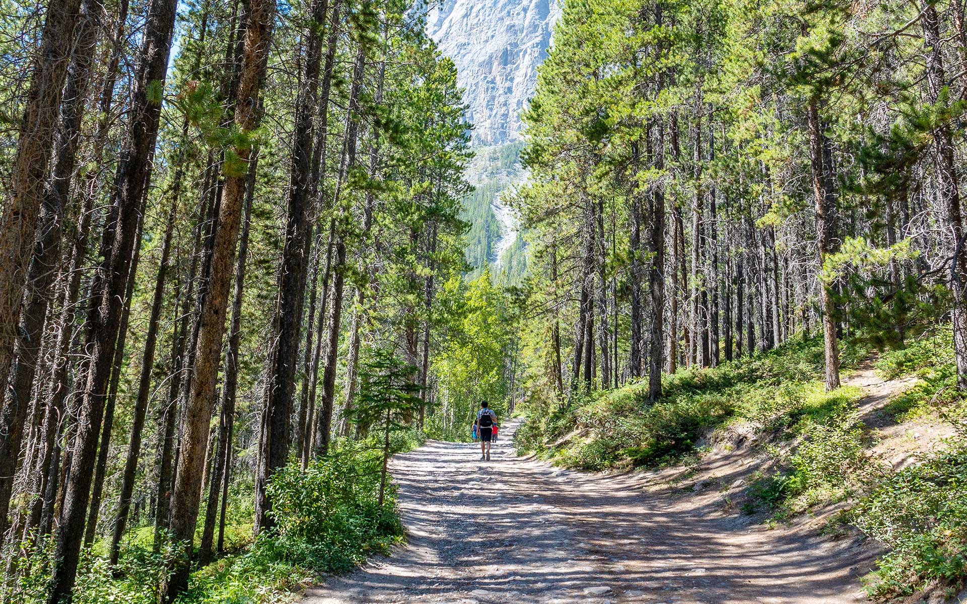
We have more of our employee’s favourite hiking trails and lakes in Alberta to share. If you missed our previous posts, don’t forget to check out parts one and two.
Hiking is the perfect workout for both your mind and body—not only can it improve your balance and stability, the time spent in nature can reduce anxiety and depression.
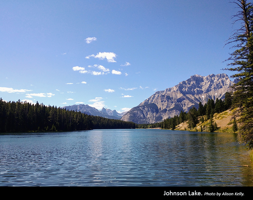
Johnson Lake, Banff National Park
”For families, people with limited ability and those who are just looking for a relatively flat but very beautiful hike, I’d recommend Johnson Lake just outside of Banff. The loop around the lake is very easy to walk. You can end your hike with a snack at one of the picnic tables overlooking the peaceful lake.
Aisling Symons
Due to its low elevation, the 3.5-kilometre circuit around Johnson Lake is an excellent option for all skill levels and accessible early in the season as the trail is often free of snow by late April. Surrounded by some of Alberta’s oldest Douglas fir trees, the trail also detours around a shallow bay where you can often spot waterfowl and muskrat. In May, you’ll find the forest floor alive with blooming purple calypso orchids. Hike the route counter clockwise for the best views of Cascade Mountain and Mount Rundle.
Johnson Lake is also a great place to canoe, kayak or paddle board. You can lounge on the beach or take a dip in the glacier water during the hot summer months. Rumour has it, there’s a secret rope swing located on the far south side, past the lake and over the bridge.
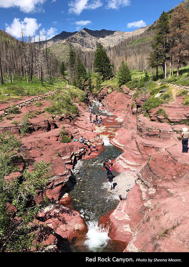
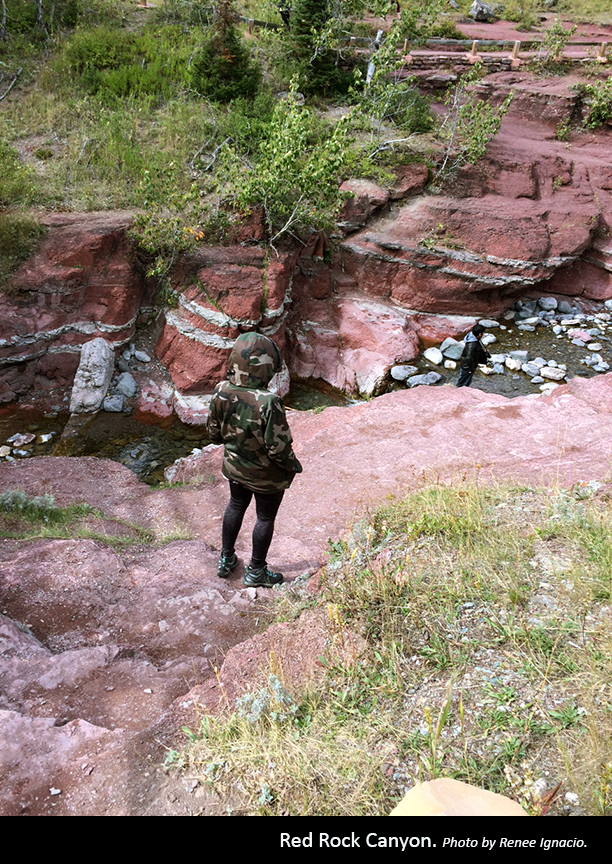
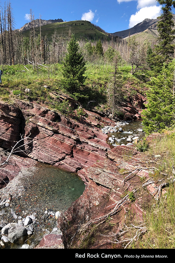
Red Rock Canyon Loop, Waterton Lakes National Park
”Red Rock Canyon is absolutely stunning, and the loop is easy for small children or anyone with limited mobility. Bring your swim gear on a hot day, so you can play in the shallow waters while admiring the red canyon walls around you. Get there early though—it’s a popular spot for both tourists and locals.
Sheena Moore
There are multiple hikes that can be accessed from Red Rock or along the parkway, ranging from short and easy to difficult, multi-day treks. The drive to Red Rock Canyon is beautiful, winding up the Blakiston valley where prairie and mountain landscapes meet.
With minimal elevation and at less than a kilometre in length, Red Rock Canyon Loop is just one easy, short trail to try and possibly combine with another hike. Starting from the same trailhead as other trails, be sure to get on the correct loop and head upstream Red Rock Creek. Interpretive displays along the trail provide information about the layers argillite rock that make up this unique canyon, some of which is over a billion years old.
The canyon deepens as the trail progresses and you eventually reach a bridge that gives you beautiful views of glacial water cascades through the creek and resting in brightly coloured pools. Explore the bottom of Red Rock Canyon for the best photo opportunities and some fun rock hopping, but be careful not to slip on the smooth, wet surfaces. After crossing a footbridge, you’ll come back to the starting point.


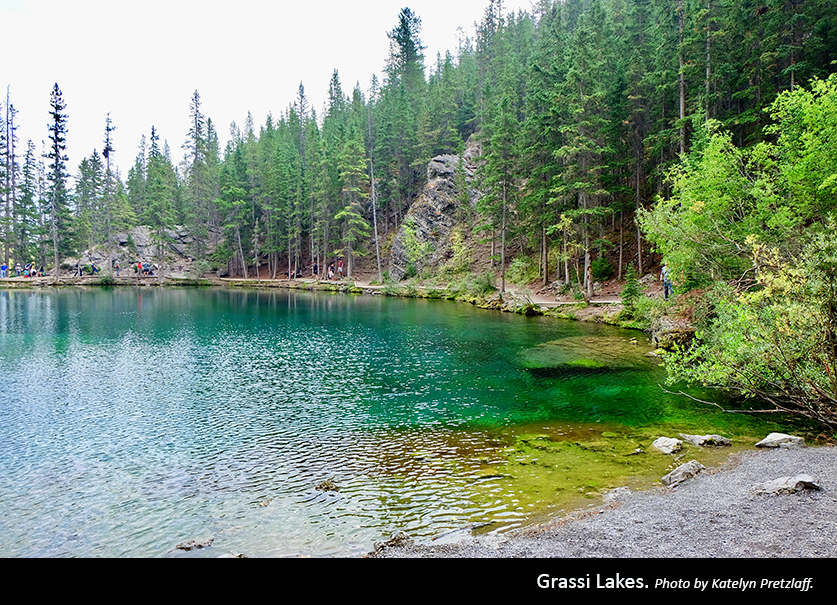
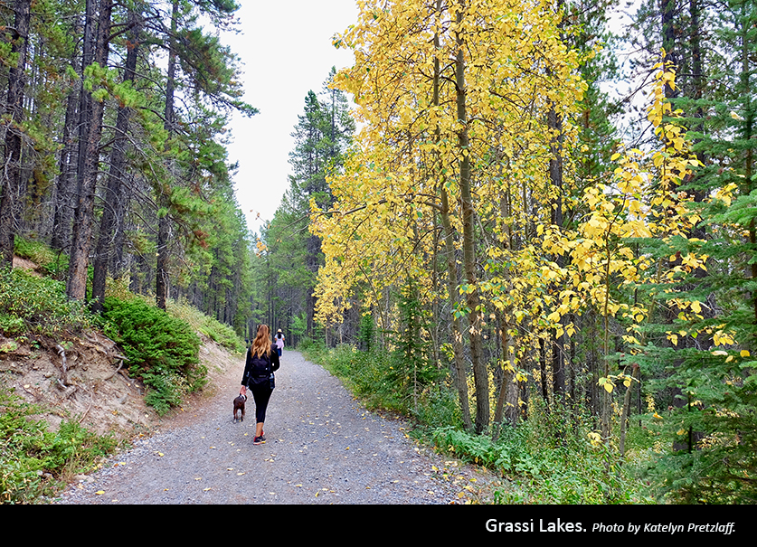
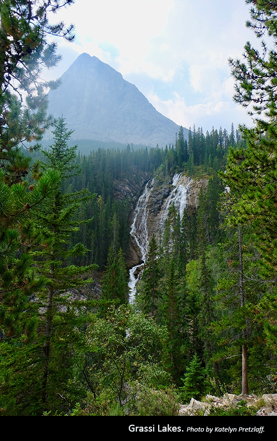
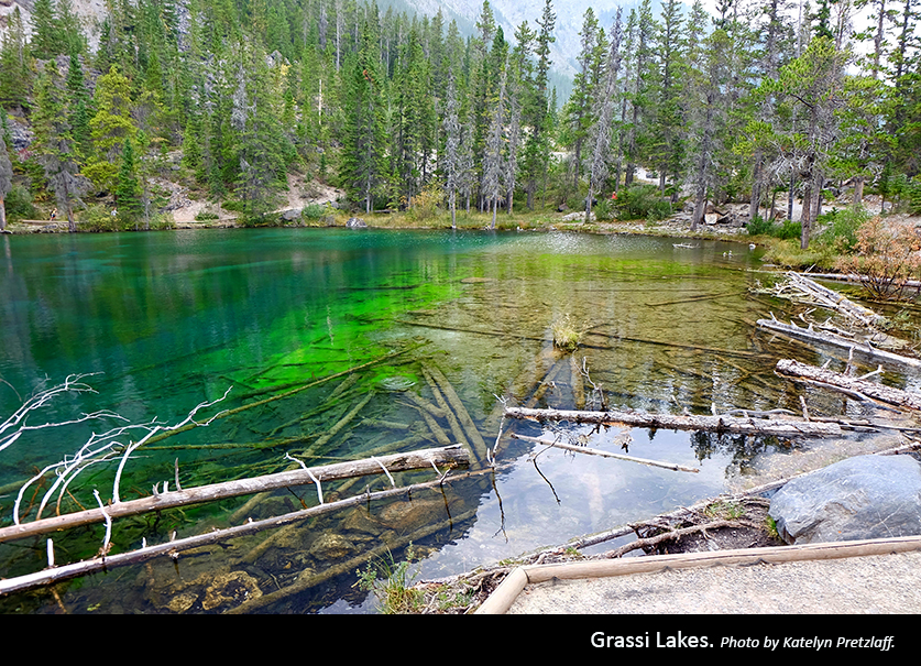
Grassi Lakes, Canmore Nordic Centre Provincial Park
”Not only are the Grassi Lakes gorgeous, this is the perfect hike to bring your dogs on. I highly recommend taking the more difficult trail up and then the easy trail down to make it a more interesting loop. Just be warned that the steps can be a bit too tall for smaller dogs to climb—I had to carry my buddy up the last bit, which my friend got a real kick out of.
Katelyn Pretzlaff
The picturesque Grassi Lakes trail featuring a pair of spectacular turquoise lakes surrounded by impressive rock faces is short and easy, making it perfect for beginners and families.
Beginning on a wide, gravel access road, you’re quickly presented with the choice between two routes. The easier trail to right—Grassi Lake Upper trail—follows an old road through a dense forest. The width and gentle incline of this route makes it manageable for all-terrain strollers and young children. The smaller, more challenging option to the left—Grassi Lake Interpretive trail—climbs gradually through forested terrain, passes by a waterfall and offers excellent views of Canmore and Bow Valley. Be careful on the stone steps at Lawrence Grassi Waterfall, which can get slippery—this route is not recommended in wet or snowy weather.
Whichever route you take, take time to enjoy the beautiful views and photo opportunities as you wander around the upper and lower Grassi Lakes. The cliffs around the lake are a popular destination for rock climbers, so be sure to look up to see if you can spot any. Depending on which routes you take up and down, and how much time you went to spend at the lakes, one to two hours is suggested for this four-kilometre hike. As one of Canmore’s most popular trails, it’s best to start early or late to avoid the crowds.


Lake Annette, Banff National Park
”I started hiking years ago when I hiked Mt. Kilimanjaro in Tanzania, Africa, and discovered a new passion! One of my favourite hikes in Alberta is Lake Annette, a beautiful 11.4-kilometre hike with gorgeous views along the way. If you go a bit further, you’ll get to Giant Steps Waterfall for a total of 20 kilometres.
Lisa Bowes
It may be the least visited valley in the Lake Louise area, but Lake Annette via the moderate Paradise Valley Trail is a spectacular hike. Featuring stunning mountain views and the beautiful lake, with the option to venture on to the Giant Steps Waterfall, you’ll want to check this one out.
Starting at the Paradise Valley trailhead, follow the well-groomed trail through a fragrant, subalpine forest along Paradise Creek. When you see the magnificent views of Mount Temple and the valley, you’ll quickly understand why it was named Paradise Valley. After crossing a few wooden bridges, about 5.7 kilometres along, you’ll reach the top of the crest for a stunning view of Lake Annette, with Mount Temple rising from its azure waters—photos don’t do it justice. This is an excellent spot to rest and eat lunch—if you’re brave, take a swim! You can head back the way you came or continue to the cascading Giant Steps Waterfall at the end of the valley.
The Paradise Valley trailhead is accessed from the Paradise Creek parking lot just off Moraine Lake Road. This parking lot can fill up by 9 a.m. in the summer, so it’s suggested to arrive early. Note that there are often hiking restrictions due to bears in the area—bring bear spray and be prepared to hike in a group (or face a hefty fine). If you don’t meet the minimum group requirement, just wait at the trailhead and link up with other hikers.
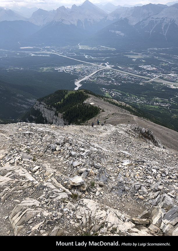
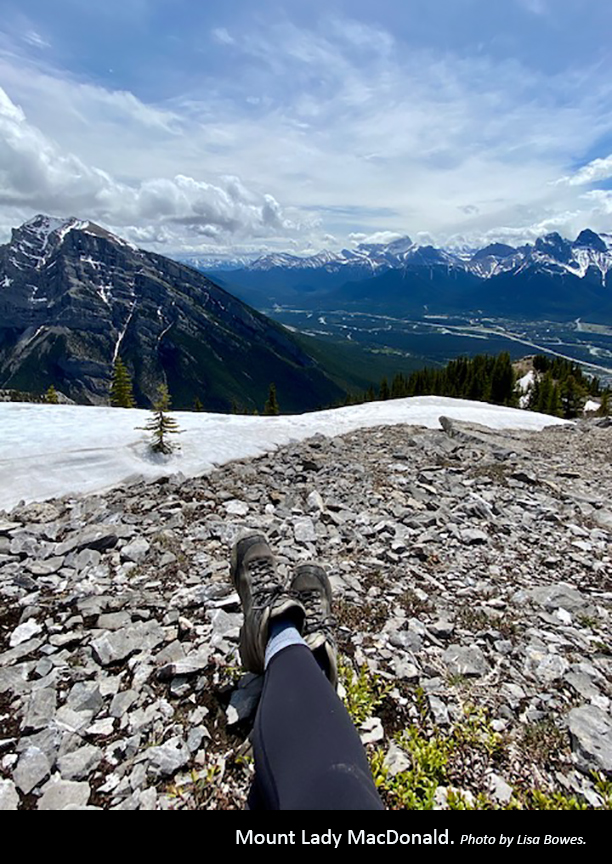
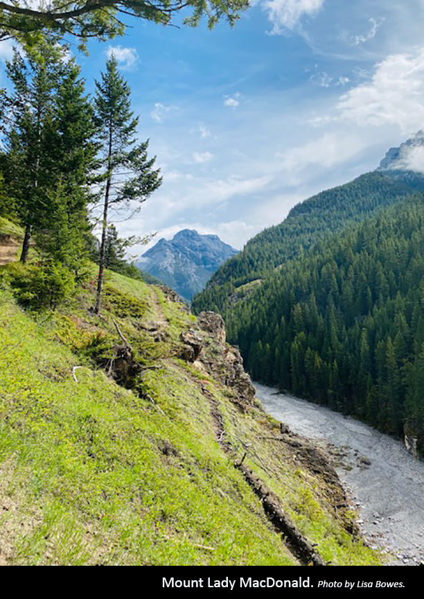
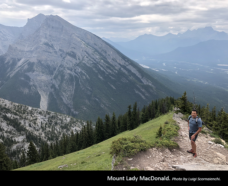
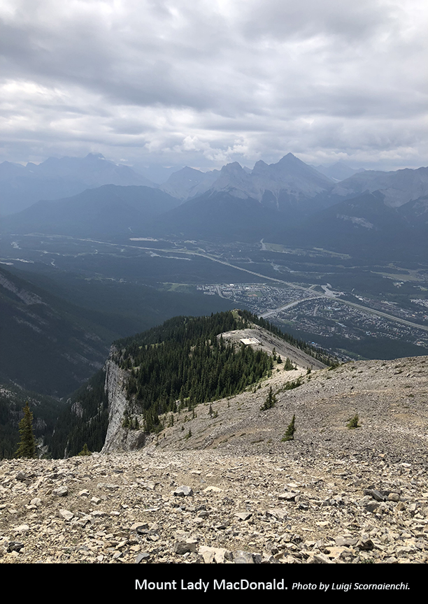
Mount Lady MacDonald, Bow Valley Provincial Park
”One of my favorite quick hikes is Mount Lady MacDonald. It’s convenient because the trailhead access is right in the town of Canmore in Cougar Creek. Although it’s a short out-and-back course totaling about six kilometres, the 1,200-metre elevation sure gets the lungs working and the loose sharp scree at the ridgeline can make it a bit tricky coming down. The platform near the top is the perfect spot for a break and to take in the beautiful views.
Luigi Scornaienchi
This short but steep trail provides wonderful views almost the entire way, particularly of Canmore. Start from the Cougar Creek trailhead in Canmore and take the path to the left when you see the sign for Mount Lady MacDonald.
The trail itself is quite well defined and zig-zags up to the former site of a teahouse. As you rise, you’ll notice smaller paths that go off, but it’s recommended to stay on the main trail. When you get to a rocky area where the trail becomes more difficult to follow, look for orange tape on tree branches. Eventually, you’ll reach a split in the path from which you can go either way. After about two hours or so, you’ll come to an old helicopter pad and the abandoned teahouse.
From here, you can continue up to a second bench where very loose and steep scree takes you to the top of the ridge and outstanding views. The last section to the true summit is an exposed scramble and should be avoided if there is snow—it’s recommended to avoid this last section unless you are an experienced climber and are willing to accept the risk of a fatal fall.
Descend the way you came, which can be more challenging than the ascent. Again, you can go either way at the split in the path, but the right path is steeper, so be sure to follow the blue and white arrow that directs you back to the main trail.


Don’t stop exploring
We hope you’ve been inspired by our employees’ recommendations to get out there and see more of what this beautiful province has to offer. If you missed them, be sure to check out parts one and two. Check out this great list by Travel Alberta for more options.
