
Both adults and children can benefit from being active outdoors, and it’s a great way to spend time with your family. According to the Government of Alberta, increased outdoor activity for children can
- help build habits towards an active lifestyle and lower the risk of future health problems;
- increase focus and concentration;
- help to improve distance vision and lower the risk of nearsightedness; and
- increase vitamin D, which may help prevent bone problems, diabetes and heart disease.
We recently shared some of our employees’ favourite hiking trails and lakes. Check out part two of our list below.
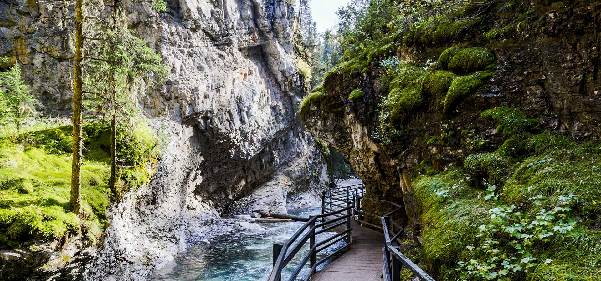
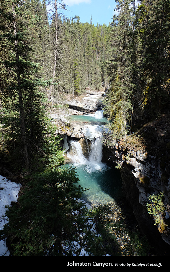
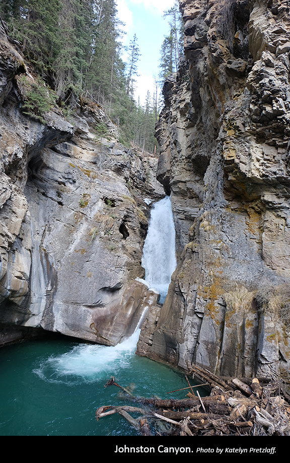
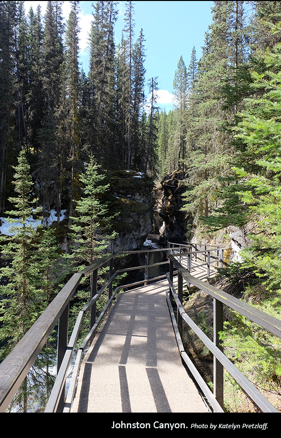
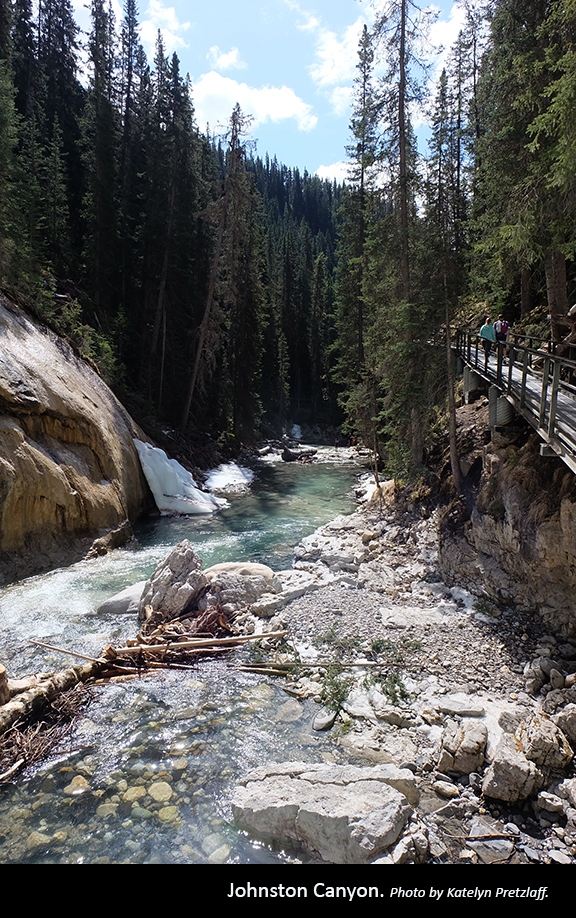
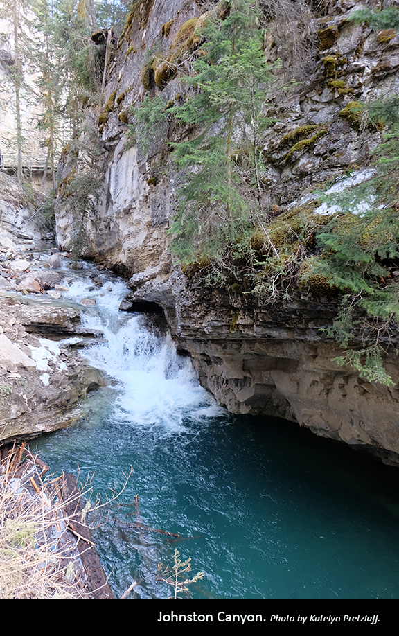
Johnston Canyon, Banff National Park
”Johnston Canyon is a great option for anyone looking for an adventure in nature that isn’t too strenuous or time consuming. Plus, it can be hiked in all seasons, giving you a new experience each time.
Kayla Sommer
Get close to waterfalls and limestone bedrock through a series of staircases and catwalks affixed to the walls of Johnston Canyon, which is comprised of two easy trails. While the trail to the lower falls offers a milder gain in elevation, both are accessible to most skill levels and are perfect for families. As one of the most popular day hikes in Banff National Park, this trek is best made in the early morning or late evening if you want to avoid crowds. It’s also a spectacular hike in the winter when the falls freeze over—just be sure to wear proper foot gear.
At the lower falls, follow a short tunnel for a closer view of the waterfalls—albeit a wet one. At the 30-metre high upper falls, there are two viewing platforms, one of which hangs above the waterfall via a steep but short climb to the top. Be mindful to stay on the trail and always keep an eye on young children.
The hike takes one to two hours to complete depending on whether you choose to visit both the lower and upper falls and how long you spend taking in the surrounding views. If you have the time, follow the forest trail beyond the upper falls to the less crowded Ink Pots—a meadow of mineral pools that sit at a constant 4°C and have basins made of quicksand.


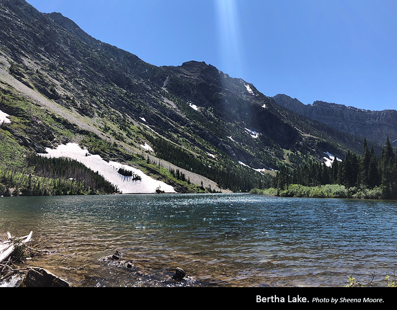
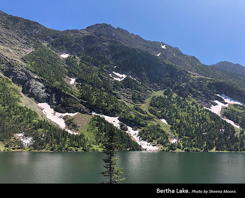
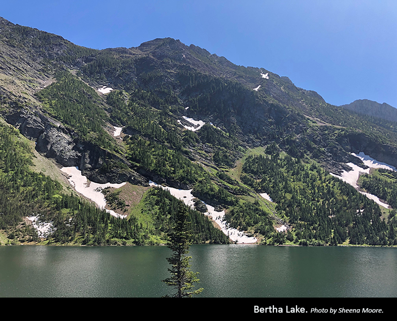
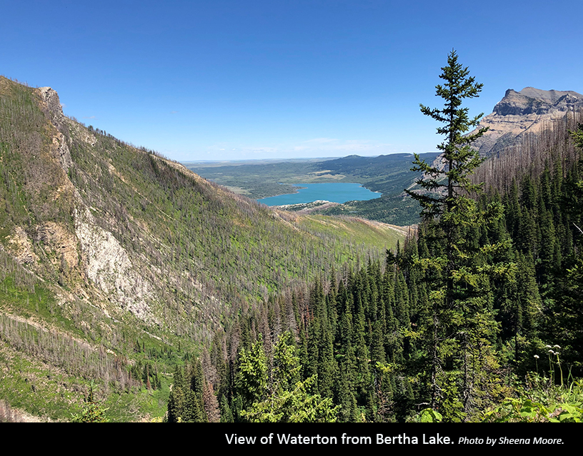
Bertha Lake, Waterton Lakes National Park
”We did Bertha Lake trail as the last part of our Waterton adventure, so we were all a little tired (except for my one crazy friend who basically ran up the trail). There were a ton of switchbacks and it was quite steep in some sections, but it was worth it in the end when we saw the piercing blue lake at the top. You could walk around the lake, but we chose to chill out and enjoy the views.
Renee Ignacio
Only 10.4 kilometres and a total time of about four and a half hours, the hike to and from Bertha Lake starts off easy and gets progressively steeper as the elevation increases in during the second half. Featuring waterfalls, sweeping vistas and an alpine lake, this trail makes for a stunning hike. Expect to see lots of people during high season due to the its proximity to the town of Waterton.
Starting from the trailhead in Waterton, take in the views of Waterton Lake as you slowly climb up to Lower Bertha Falls, where you can take a short break on one of the benches. From the junction a short distance later, there’s a lookout point for sweeping views of Vimy Peak, Mount Boswell and Glacier National Park in Montana. Continuing back on the main trail, bear right and cross the wooden bridge over Bertha Creek. A series of switchbacks mark the point in which the trail becomes more challenging, but you’re frequently rewarded with views of the valley below.
As you near your destination, you’ll see the cascading waters of Upper Bertha Falls and, a short distance later, breathtaking views of Bertha Lake surrounding by the mountains. Take the four-kilometre loop around the lake or pick a spot on the shoreline to rest and simply take it all in. There is a backcountry campground to the right of the lake over a wooden bridge if you wish to stay overnight. To return, simply go back the way you came.

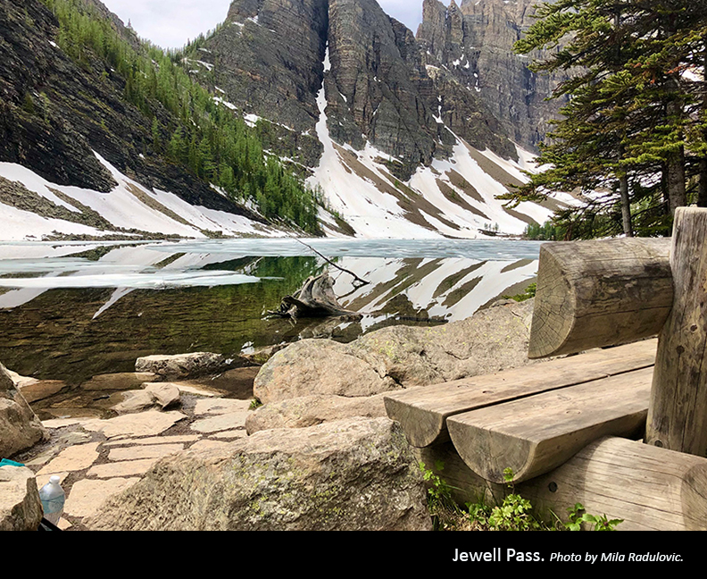
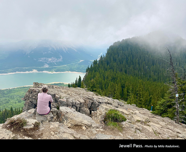
Jewell Pass, Bow Valley Provincial Park
”Jewell Pass via Prairie View Trail, near Canmore, is great hike—its about a 15.9-kilometre loop with an elevation of 823 metres.
Mila Radulovic
Prairie View Trail—also known as the Barrier Fire Lookout Trail—begins at the Barrier Dam Day Use area and switchbacks up an old forestry road to an amazing viewpoint that looks over Barrier Lake. While many hikers continue from here to the north side of the ridge to the Barrier Fire Lookout, the lesser-obvious trail on to the left descends towards Jewell Pass and provides a much more interesting experience.
Following this trail, you’ll come to an intersection from which you follow another series of switchbacks up the hill, which can be icy in the fall and spring. The view of Barrier Lake when you pop out of the trees into a meadow is quite spectacular. From here, continue along the ridge trail until you reach a steep, but short, section with multiple routes up—all lead to the high point on Prairie View Trail with even better views of Barrier Lake and Mount Baldy.
From here, you can return by retracing your steps back or complete a loop by gradually descending McConnell Ridge to the Jewell Pass trail and, eventually, Stoney Trail, which takes you back to the intersection at the start of the hike.
While considered a moderate trail, it’s recommended that you wear warm clothes and proper footwear and bring poles if hiking in the late fall or early spring.


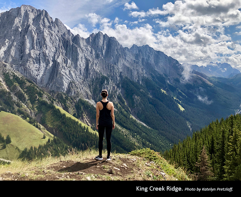
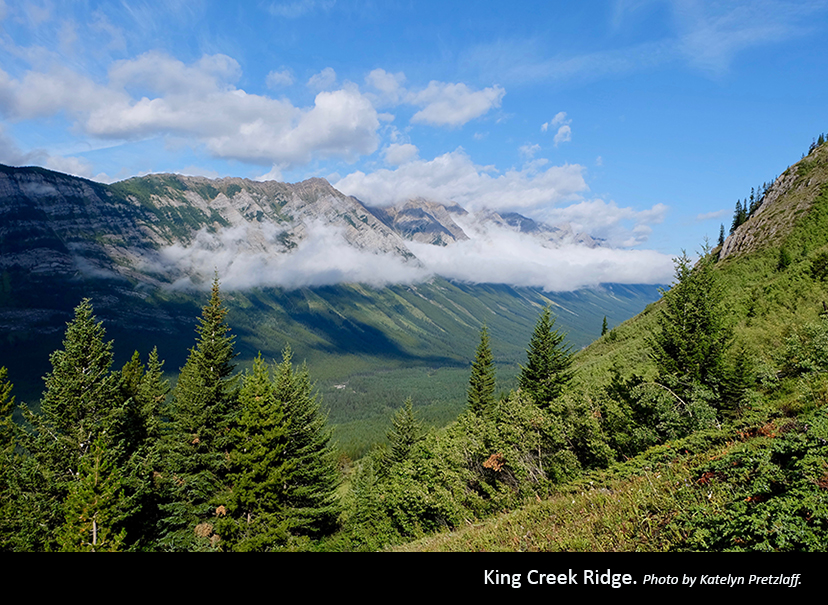
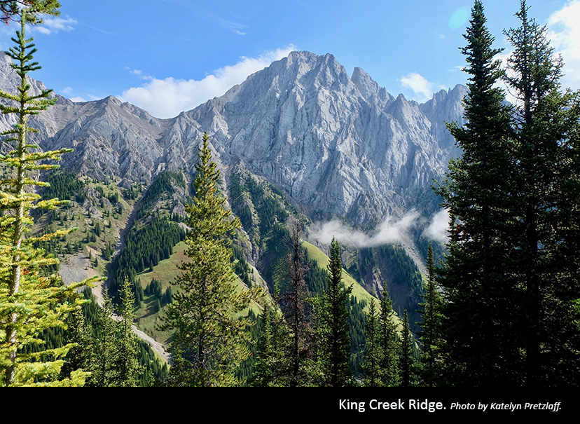
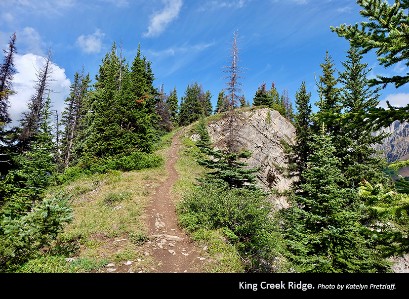
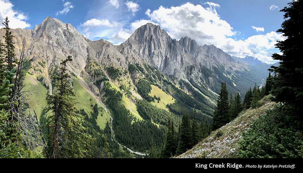
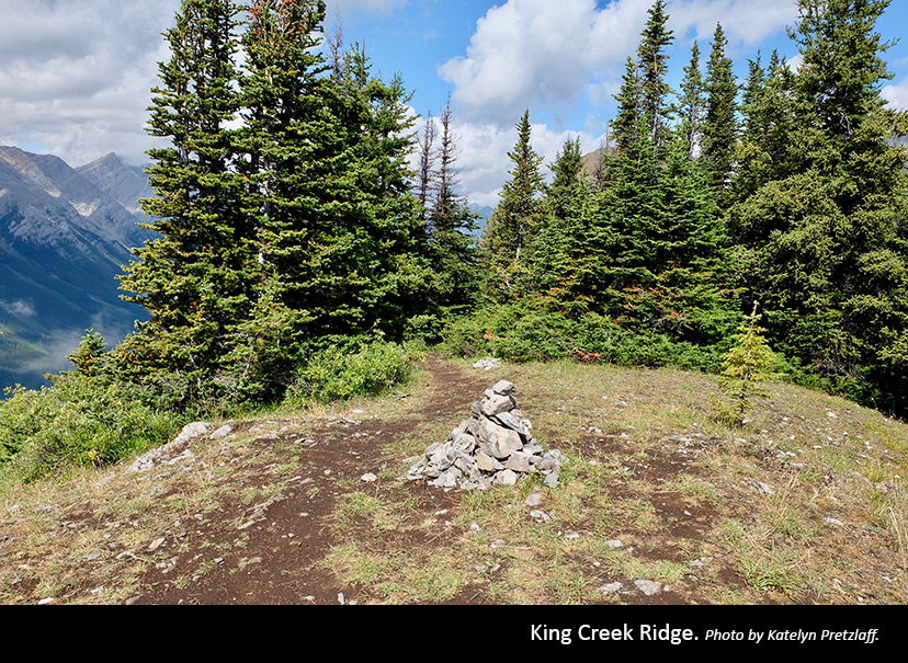
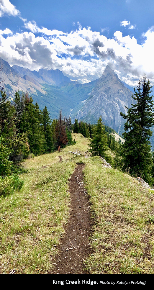
King Creek Ridge, Peter Lougheed Provincial Park
”King Creek Ridge is one of the best hikes I’ve done so far. The steep ascent made me question what I was getting myself into, but we took lots of breaks and the gorgeous views at the top are so rewarding.
Katelyn Pretzlaff
While the hike to King Creek Ridge may seem relatively short at a total of about seven kilometres, the first kilometer gains 2,200 feet in continuous elevation with only the slightest of switchbacks. Avoid taking any braided trails blocked off with logs or rocks and take frequent breaks to enjoy the views below. The trail levels off when you reach the ridge, greeting you with breathtaking views of the surrounding mountains and the Kananaskis lakes—this is a great place to rest. To reach the true summit with stunning 360-degree views of the Opal Range, Mount Wintour and Tombstone Mountain, go left past the cairn and take a final, mild scramble up.
Returning the way you came, this hike can range from a total of three to five hours depending on how experienced you are and how long you spend at the summit. The steep grade and loose rock make this hike quite challenging, particularly on the descent—good hiking boots and poles make it easier.
The unmarked trailhead can be a little challenging to find. Starting from the King Creek Day Use area, walk back to Highway 40 and turn right to follow the little path that cuts between the highway and creek. At the first junction, stay left to continue to the ridge. Upon your arrival and departure, keep an eye out for mountain sheep that frequent this area.


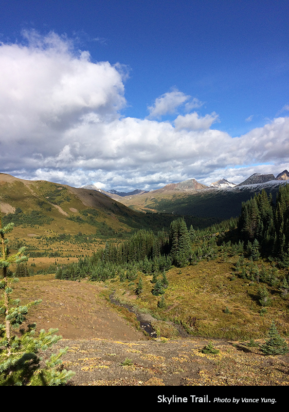
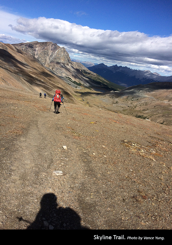
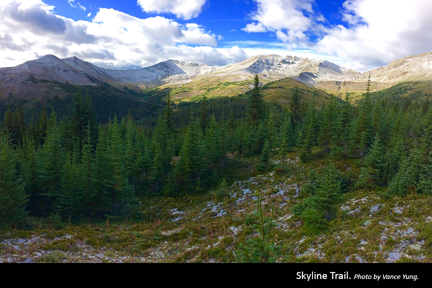
Skyline Trail, Jasper National Park
”The Skyline Trail is an amazing 44-kilometre adventure. I’ve done it twice, starting from the both ends. It crosses three mountain passes, with a great variety of scenery and, from my experience, weather. There are a few challenging points, including digging ourselves out of our snow-covered campsite, but those are the fun parts.
Vance Yung
Skyline Trail is the highest—and possibly most scenic—trail in Jasper National Park, with almost 25 kilometres of the trail situated above the treeline to reach a maximum elevation of 2,510 metres. The high elevation allows for exceptionally beautiful views that extend over much of the park and encompass vast meadows, windswept ridges and the chance to spot wildlife from a distance. Traversing the Maligne Range, the trail offers a variety of flora, fauna and scenery unique to Jasper National Park.
This trail is considered difficult and takes an average of two to three days to complete. As Jasper’s most popular backpacking trail, and one of the busiest in the Canadian Rockies, it’s recommended you book your campsites in advance. Skyline Trail is known for its challenging weather and snowfall can occur even in the summer months, so be prepared for changing weather conditions.

